Program: Statistics & Environmental Science
Projected Grad: 2022
Advisor: Zhengyuan Zhu
Presentation Title:
Finding Iowa’s Grassed Waterways via Deep Neural Networks
Summary:
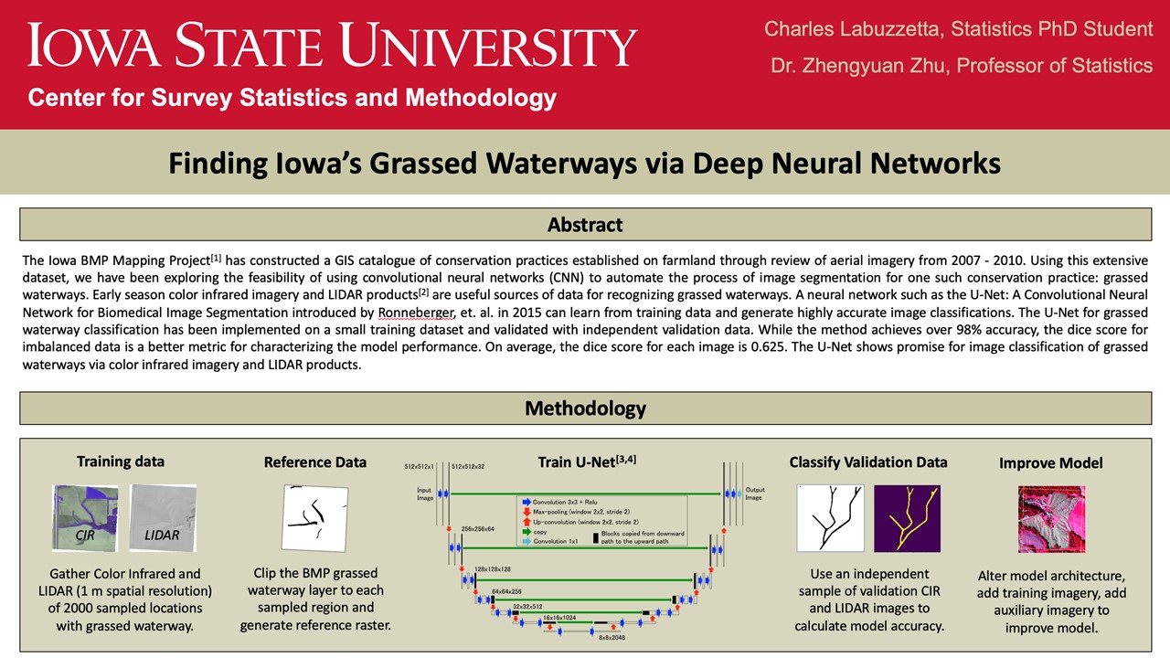
The U-Net shows promise for image classification of grassed waterways and other BMPs via color infrared imagery and LIDAR DEMs.
The Iowa BMP Mapping Project has constructed a GIS catalogue of conservation practices established on farmland through review of aerial imagery from 2007 – 2010. Using this extensive dataset, we have been exploring the feasibility of using convolutional neural networks (CNN) to automate the process of image segmentation for one such conservation practice: grassed waterways. Early season color infrared imagery and LIDAR DEMs are useful sources of data for recognizing grassed waterways. A neural network such as the U-Net: A Convolutional Neural Network for Biomedical Image Segmentation introduced by Ronneberger, et. al. in 2015 can learn from training data and generate highly accurate image classifications. The U-Net for grassed waterway classification has been implemented on a small training dataset and validated with independent validation data. While the method achieves over 98% accuracy, the dice score for imbalanced data is a better metric for characterizing the model performance. The U-Net shows promise for image classification of grassed waterways via color infrared imagery and LIDAR DEMs and results for other BMP practices such as pond dams, terraces, and WASCOBs are equally encouraging.
Poster link